As part of the ACCORD project we have been developing tools to accelerate the development and deployment of regional ocean models.
The primary advantages of bespoke configuration are:
- The resolution of the region of interest can be finer than with freely available (typically global or macro-regional) datasets.
- The experiments can be customised in terms of variables carried and/or frequency of output.
- Regional models can computationally cheap to run and make their translation to partner nations easier.
Rapid deployment has two parts: Part 1: Configuration and Part 2: Validation.
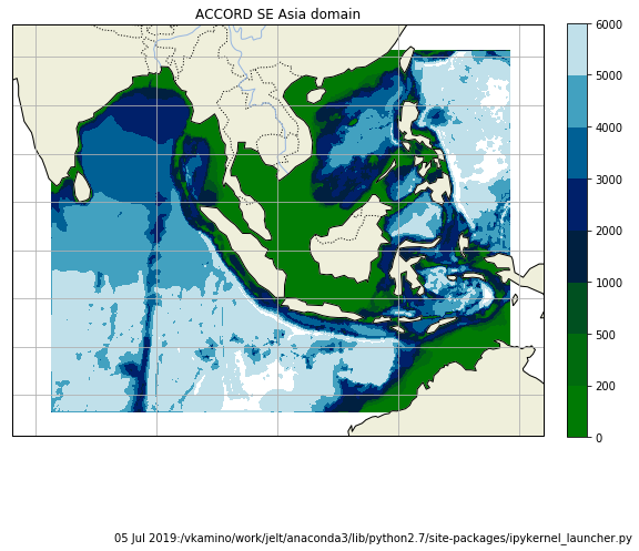
As part of ACCORD we are building a 3D physical (NEMO) plus ecosystem (ERSEM) model of South East Asia. This configuration spans 75°E to 135°E and -20°N to +25°N. The model grid has 1/12 degree (approx. 9km) lat-lon resolution and 75 vertical levels, which follow the terrain in shallow waters.
As a result of the ACCORD rapidly deployable workflow, a number of other projects have been supported and configurations have been built (including but not limited to):
A locally hosted surge model of Madagascar Met Service: (C-RISC)
A 3D regional model of the Caribbean (CME; github)
A 3D regional model of East Africa (Solstice)
This activity has been recognised as transformative and is now supported under CLASS.